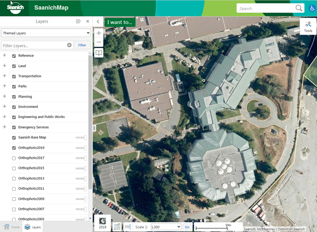
2019 aerial photo is now available in SaanichMap
August 14, 2020
August 14, 2020
2019 aerial photo is now available in SaanichMap
The 2019 aerial photo is now available in SaanichMap. Have a look at the new photo at map.saanich.ca
The 2019 aerial photo has 10 cm resolution and was flown in July, 2019 as part of a collaborative effort between the CRD and member municipalities.
You can access aerial photos in SaanichMap by checking them on in the Layers list on the left, or by selecting them in the Basemap selector at the lower left corner of the map. Ten historical aerial photos dating back to 1997 are available and you can toggle between years and adjust transparency by using the slider bars.
Contact:
250-475-5448
gis@saanich.ca